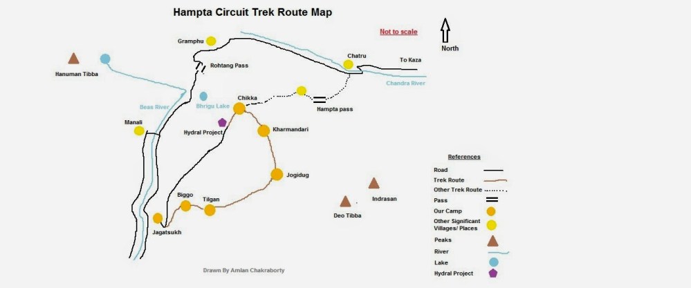
Hampta Circuit is a virgin trek route in Himachal Pradesh. Although Hampta pass is a known route for trekking but Hampta Circuit has not been explored by any Indian common people. However, porters, army and some foreigner have trekked through this route. On 2014, our team (consisting of 6 members) lead by Mr. Indranil Kar (CEO of Ongoz Escapeds) opened the route for rest of the year.
Planning of the trek:
Earlier trekking meant only Alpine style where the trekkers had to carry their luggage, ration, kitchen utensils with them and the trekking were extremely technical, tough and hectic for common people. But some British lords who wanted to celebrate their holidays by trekking took servants, porters, cook with them. Still there are some organizations who arrange only alpine trek. Mr. Indranil Kar thinks it in different way; he arranges everything for the trekker so that the trekker can trek only with his camera. The entire luggage is carried by the porter and mules. So the trekkers just walk and enjoy the nature, capture photographs and the entire trek becomes lords’ holiday.
I personally think, alpine style is not my cup of tea. I had previous experience to trek with Indranil. So, when I decided to explore Hampta Pass, then I contacted with him. He allotted a birth for me in his team. We went to Manali for Hampta Pass, but due to heavy snow Hampta Pass was not accessible. Since Indra has a great network across the India, he quickly decided to change the route and to explore a virgin route – Hampta Circuit.

Geography of the route:
Physically the route is in between Dhauladhar and Pir Panjal range of Himalaya at the east side of Beas.
Best Time:
This route can be explored any time between May to October but the best time is in the mid of May due to snow. From the beginning of June snow starts melting.
Detail of the trek:
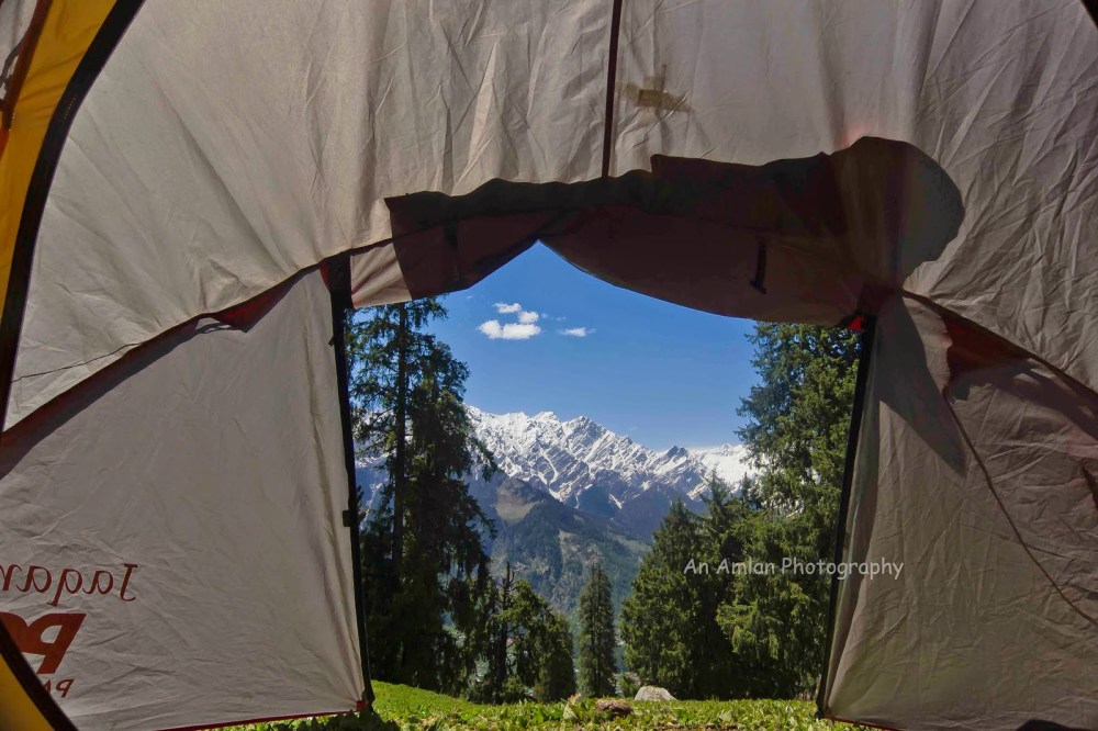
This trek requires 6 days from Manali to Manali which includes 5 nights in tent. The walking will start from Jagatsukh which is just 5 kilo meters away from Manali. People can stay anywhere in Manali but we stayed in a hotel for us at Jagatsukh. I will suggest staying there at Jagatsukh as Jagatsukh is very calm and quiet compared to crowded Manali.
Day 1 – Manali to Jagatsukh by car, Jagatsukh to Biggo by trekking (3.5 hours):
Altitude Start: 2012 meter
Altitude End: 2400 meter (approximately)
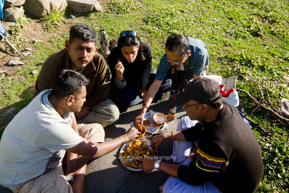
Drive to Jagatsukh village from Manali or if you stay at Jagatsukh then drive to the village. In our case, the guides, porters and cooks were waiting for us at the base camp. We left our luggage to the porters; they packed it and put it on the back of mules. We started our trekking; each of us was given a lunch box filled by Cadbury, fruit, boiled egg and sandwich. This is required as during walk, people can feed him/her self.
We started in a muddy and steep way covered by hedge full of prickly shrubs; the trail was visible at that area. After walking almost 1.5 – 2 hour, a prominent bifurcation was visible in the trail. We took right turn from here.
The trail was less steep from this place. Walking along the trail, suddenly we found a tomb of temple. We were suggested to walk towards it and the road lead us to Banara Temple – a temple of Naga. According to Hindu mythology, Naga is the god of snake. The guide, porters and cook prayed there for the safe trek.
Here the trekkers are advised to follow guide’s instruction before roaming around the temple because walking in a certain portion of the temple area is prohibited.

We took a break for half an hour and had lunch. Our porters suggested us to refill water bottles. After half an hour, we started trekking through a very less steep trail surrounded by apple trees. After walking almost two kilo meters we reached Biggo.
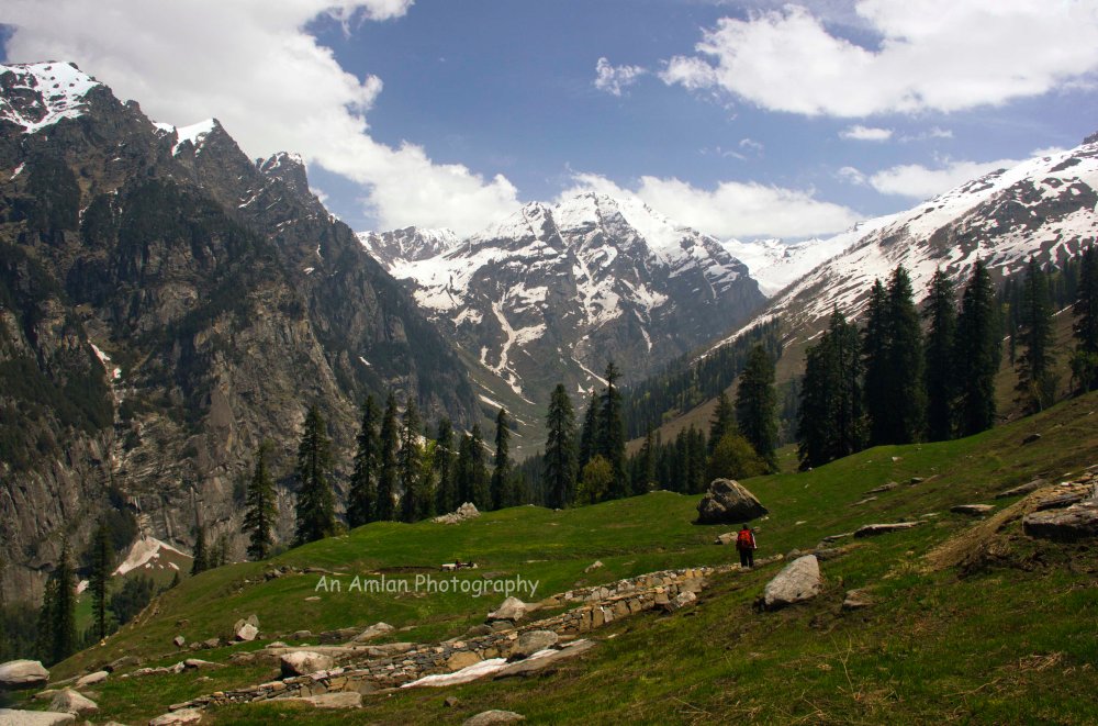
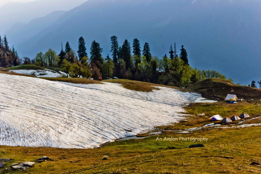
The name “Biggo” is derived from the word boogial (meadow). Biggo is a meadow where we camped first night. This meadow is surrounded by trees like pine, far, oak, maple. The natural light and shadow through the forest was a very enjoyable part of this day. It was a sunny day and great Dhauladhar Range of Himalaya was smiling from the opposite of our camp.
Teas with snacks were served right after we reached the camp. We enjoyed two rounds of tea and had chat with local villagers who stays in nearby villages and goes there to collect wood.
Biggo can be a paradise for bird watching. We found various types of Himalayan birds, although none of us knew the name of them.
We spent the evening with warm drinks and mouth watering snacks prepared by our cook followed by a wonderful curry of wild hen.
Day 2 –Biggo to Tilgan (2 hours):
Altitude Start: 2400 meter
Altitude End: 2470 meter
Day 2 was a relax day. Only 1.5 kilometres distance was trekked through a less steep trail. The trail was created by local wood-cutters. After breakfast, the journey started through soothing greenery. It seemed like alpine trees like Pine, Maple, Walnut, Oak, Alder trees were blessing us by creating calm and cold shadow so that we do not get sweated in the sunny day. On the way, pine cones were kissing our feet and made our journey very romantic. Broken stems of the above said trees were scattered here and there on the trail.


Charas plant was found on the way. Charas is a higher version of Marihuana. It is very interesting that Charas trip is known as “Manalu Trip” as this plant is found in Manali region.
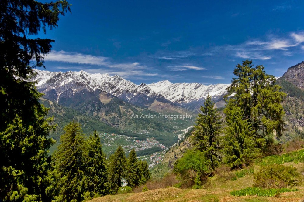
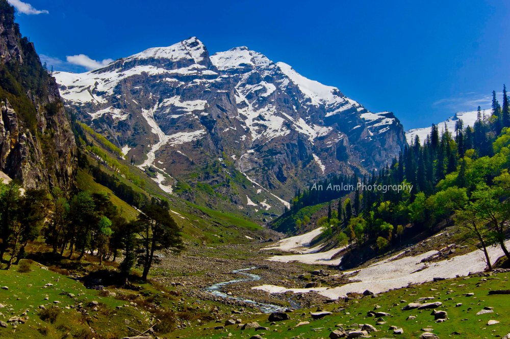
Great Himalayan Dhauladhar range and Pir Panjal range were visible under the turquoise blue sky on the left side of the trail. Since the day was clear, a top view of Manali city was visible from this region.
The peaks visible in the above image are Ladakhi(5342 meter), Manali(5669 meter), Sitidhar(5294 meter), Mukar Beh(6069 meter), Friendship Peak(5289 meter). After walking nearly 2 hours, we reached Tilgan. Tilgan is a meadow located at a height of 2525 meter and in front of a range of alpine forest.

Dhauladhar range and Pir Panjal range are opposite to this meadow, so a panoramic view of the range can be visible from here.

Since the next day was going to be more hectic, we had early diner right after the sun set and went to bed.
Day 3 – Tilgan to Jogidug (10 hours):
Altitude Start: 2470 meter
Altitude End: 3050 meter (Highest point of the day was at 3200 meter)
This was the toughest day as well as most enjoyable day from scenic point of view. We got up earlier and had early breakfast.
We started walking from 2525 meter and climbed up to 3200 meter, then trekked down to Jogidug at 2800 meter. Most portion of the road was snow covered and we were the root openers, there was no trail. Our guide and porters had to break ice by ice breaker and created trail for us.
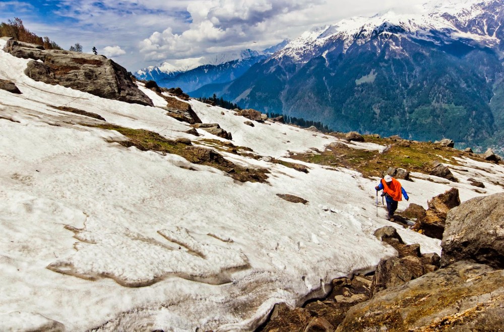
The day started with a very steep uphill trek. The weather was cloudy.
After a breath choking trek of 2 hours, snow patches started – this was the first snow of the trek, we enjoyed a lot. Gradually the snow increased. Suddenly we found the Chandrabhaga Peak (6,164 meter).
The surrounding became white from this place. We enjoyed every moment during walk although it was a steep ascend but we were spellbound by after seeing the beauty of the nature.
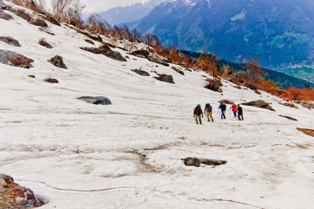
Walking on the snow for almost 3 hours we reached a place which was the highest point of our trek (3200 meter). The entire area was snow covered but we found some stones where we sat and had packed lunch. We stayed there for 20-30 minutes.
After lunch we started trekking down through the snow covered way. Suddenly we found a place which was very steep and there was no other way to bypass that area. After breaking the ice by our porters the trail became like the below photograph. Our porters helped us to cross that area.

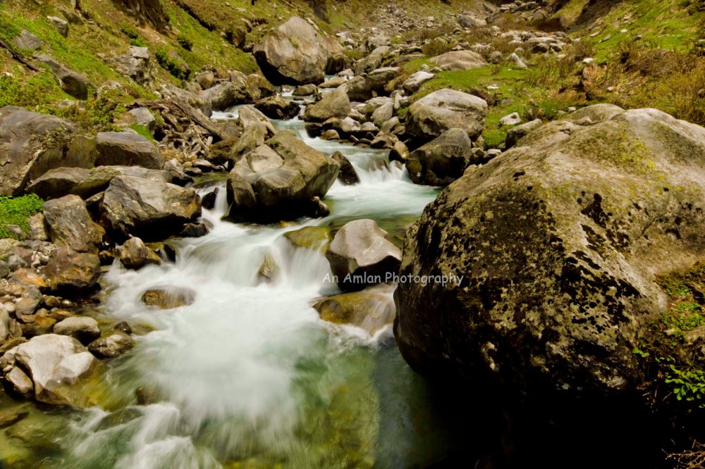
After crossing that area the trail became less steeper. Suddenly we found a frozen canal. We heard the sound of stream from the bottom. Actually, the upper portion of the canal was frozen but water was streaming in the lower portion.
From this place it took one hour to reach our third camp Jogidug. It started raining. Our cook cum guide was so efficient that right after reaching at the camp, they served hot soup with smoked papad. We got instant energy after having the soup. One of our porter arranged camp fire by collecting woods.
Jogidug is as usual a meadow. It is a holy place. There is a small water stream of drinking water and a small symbol of Lord Naga is there. During summer, a priest goes there once in a week for worship. The meadow is surrounded by alpine forest. Panoramic view of Pir-Panjal range can be visible from this place.
Since we were tired and the weather was not good we called a day very early.
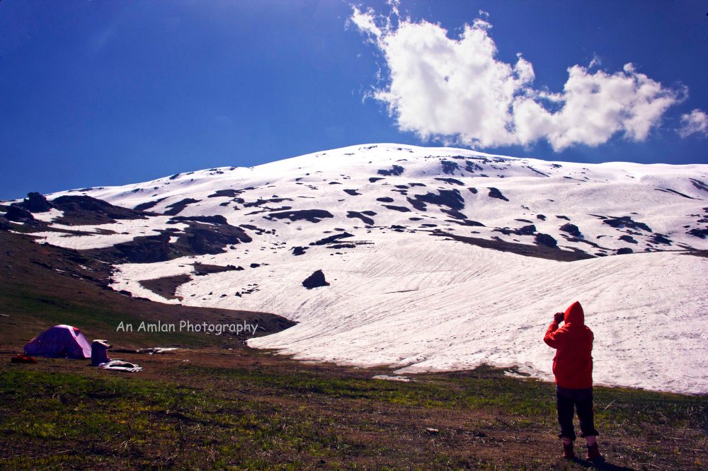
Day 4 – Jogidug to Kharmandari (5 hours):
Altitude Start: 3050 meter
Altitude End: 3005 meter
We got up late and after breakfast we started our fourth day trekking. The weather was good in the morning. There was a short cut way directly to Kharmandari, but since we wanted more ice and a better view, we started to climb up. Our intention was to trek by the ridge of the adjacent hill up to its peak, but due to heavy snow, our team lead and guide decided not to trek up to the hill but on that time it was not possible to trek back in the same way, as the road was very steep. In the entire root the view was awesome. Snow patches and greenery gave the extreme pleasure to eyes and mind. I am really unable to express the beauty but I am giving the photographs below. It was the best day for photography.

Just before reaching to Kharmandari, we found this heavenly natural garden.

Kharmandari is as usual a meadow surrounded by snow patches. The entire meadow was surrounded by snow. We enjoyed sliding in snow.

From Kharmandari, we got a panoramic view of Pir-Panjal range. Since the light condition was good, we spent the entire afternoon with photography.
The night sky was amazing, after diner when we came outside of kitchen tent and looked at the sky we got spellbound. Millions of stars were blinking.

When we went inside the sleeping bag, the poetic rhythm of the above said stream was still coming to our ears.
Day 5 – Kharmandari to Chikka (4 hours):
Altitude Start: 3005 meter
Altitude End: 2750 meter
The day was glorious. A perfect day for photography, we continued our photo session. Since there was not much walk, we started late.
Trekking was started by a steep downhill. After trekking near about 30 minutes we came to an unknown forest of alpine tree. We got a nice combination of greenery and snow. After the forest ends, we came to a pristine place which was extremely colorful. A small colorful valley, surrounded by greenery and a snow caped mountain was at the background. It was just like heaven.

We took a break in that valley and started walking again. After the valley we found a steep descend through a forest consists of Pine, Maple, Walnut, Oak, Alder; suddenly we found the beautiful Rani Nala. Rani Nala is a small stream of water.
We took a photographic break and then started walking. The trail led us to Chikka.
Chikka has lush green grass so you will find some sheep or grazing there, nestled in between of rocky mountain face and pine and maple trees. It was our last camp. We chit chatted almost up to mid night with warm drink, mouth watering snacks followed by a wonderful diner prepared by our cook.
Day 6 – Chikka to Manali (One hour trekking, then one hour by car):
We came out of the tents and sleeping bags for the last time. Started walking towards Hydral Project where our car was waiting for us. After driving a bit we found a small beer shop. Like the other treks we celebrated a beer party accompanied by pakora. At the end of the party, we came back to Hotel.

The trek was awesome. All of us thanked Mother Nature for blessing us in the entire trek. Our special thank to our guide, cook, porters, and the mule carrier. Actually I personally feel that guide and porters are the real heroes in any trek or expeditions. They created the trail by taking life risk. Our guide cum cook served us delicious food time to time without any repetition of menu. Our mule carriers have done a great job.
Our special thanks to Mr. Indranil Kar (Founder and CEO of Ongoz Escapades) for organizing this trek.
Going
Go to Manali by Bus/ Car from Delhi. From RK Ashram bus stand of Delhi, busses start, in fact, from Kashmeri Gate, HPTDC busses start for Manali.
People can go by train from Delhi to Kalka. From Kalka, Shimla can be reached by heritage toy train. From Shimla, Manali can be reached by bus or car.
Staying
There are many hotels in Manali but as I said earlier that staying Jagatsukh is a very good option. The room must be booked earlier. People are asked to carry a photo ID proof.
For more information please contact me at 9831711287
References:
1. Paye Paye Pahare (Bengali) by Pradip De Sarkar

Hey Amlan,An excellent read. This is Subhrajit from http://www.adventureclicknblog.com and we would love to have your blogs listed in our website. We have also launched a credit system for contributions by which contributors can reimburse the points for cool travel stuffs (adventureclicknblog.com/moreblognearn.php). The credit points are a way of saying thank you for your sincere effort and time for writing. Regards,Subhrajit,Subhrajit.ghadei@gmail.com0091 8378997510Education: B.Tech (IIT Bombay) & MBA (IIM Lucknow)
LikeLike
Good one. Its a complete guide about Jagatsukh. Keep sharing post like this. Check out all best hotels in Jagatsukh also.
LikeLike
Your blog is nice blog and it gives us more information. Thanks for sharing it with us.Hampta Pass trek starting from INR 8600. Get quotes from multiple operators for your requirements. Compare easily and book your trek from any operator on Mojhi.
LikeLike
After reading this I will no longer call my hikes “treks” anymore. What I do is a walk int he park compared to this.
LikeLike
I like studying and I conceive this website got some truly useful stuff on it! .
LikeLike
glad to be one of many visitors on this awesome site : D.
LikeLike